Kilshannig / Cill Seannaigh
Medieval Church and Cross slab
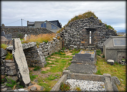
On returning to the mainland from our visit to the early Christian settlement on Illauntannig, the largest of the Magheree Islands, we drove to Kilshannig church to see the stunning cross slab. Sadly earlier this year, 2021, the west gable of the church collapsed and is just a pile of rubble, luckily the cross slab is leaning against the interior of the north wall. Illauntannig and the Early Christian settlement here at Kilshannig are traditionally associated with St Seanach. The settlements were probably established sometime around the 7th/8th century. All that remains of the early foundation here at Kilshannig is the cross slab. There are records of a Parish Church here in 1302, but the present church is believed to be a 15th/16th century refurbishment.
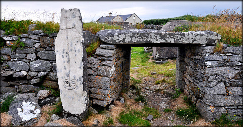
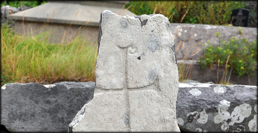
The cross slab stands 1.42 metes high and bears latin crosses inscribed on the north and south faces. Jose's beautiful shot of the north face, shown below left, features the latin cross with expanded terminals. The image below right shows the stunning latin cross inscribed on the south face. The expanded terminals at the bottom of the cross terminate into a spiral motif and the top of the shaft features a small loop to the right, which represents the chi-rho symbol.
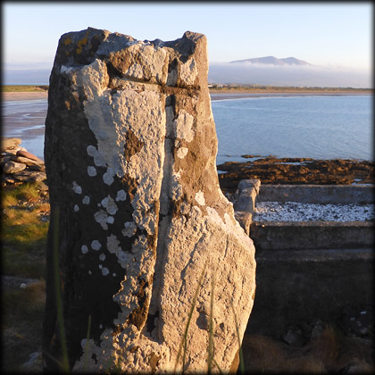
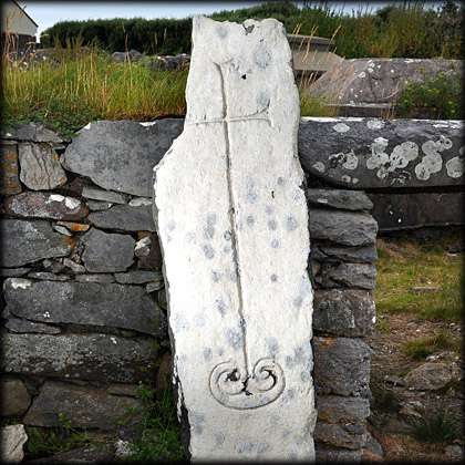
It is believed the Chi-Rho symbol was introduced in the 4th century by the Emperor Constantine, who became a champion of Christianity. The First two letters of Christ's name in Greek, Chi and Rho , were combined together. On the Chi-Rho monogram or Christogram, X represents Chi and P represents Rho. The small loop attached to the the terminal of the latin cross, see image below, is a version of the rho loop and represents the Chi-Rho. This simplified Chi-Rho monogram can also be found inscribed on a cross inscribed boulder at Coumduff and on the east face of the ogham stone at Arraglen, these two examples are also located on the Dingle Peninsula.
Situated: Kilshannig Church is located to the west of the village. Head north on the Magharees Peninsula, look to your left as you enter the village the remaining east gable of the church can be seen on the shoreline of Scraggane bay.
Discovery Map 71: Q 6254 1949. Last visit July 2021.
Longitude: 10° 00' 59.3" W
Latitude: 52° 18' 36.6" N
Photos: Jim Dempsey and José Gutiérrez.